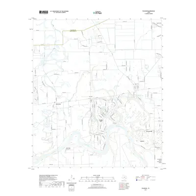
2019 Map of Fulshear
USGS Topo · Published 2019About this map
The Brazos River meanders through this section of Fort Bend County, defining the southern landscape with its broad oxbows and riparian wetlands. The settlement of Fulshear anchors the southeast corner, while the newer residential developments of Weston Lakes and the established community of Simonton sit along the winding path of Bessies Creek. Local history is preserved at the Little Prayer Cem near Pool Hill, a notable high point in this otherwise low-lying coastal plain.
Find a feature on this map
120 named features on this map. Tap any name to fly to it.
Don’t see what you’re looking for? This feature index may not catch every label — zoom into the map to look around manually.
Map Details
Editions of this 2019 Fulshear Map
This is the sole edition of this map. No revisions or reprints were ever made.
Other maps of this area

1915 · Katy
USGS Topo · 1:24,000

1950 · Houston
USGS Topo · 1:250,000

1953 · Seguin
USGS Topo · 1:250,000

1955 · Brookshire
USGS Topo · 1:62,500

1955 · Richmond
USGS Topo · 1:62,500

1956 · Sealy
USGS Topo · 1:62,500

1956 · Wallis
USGS Topo · 1:62,500

1956 · Houston
USGS Topo · 1:250,000

1958 · Seguin
USGS Topo · 1:250,000

1960 · Wallis
USGS Topo · 1:24,000