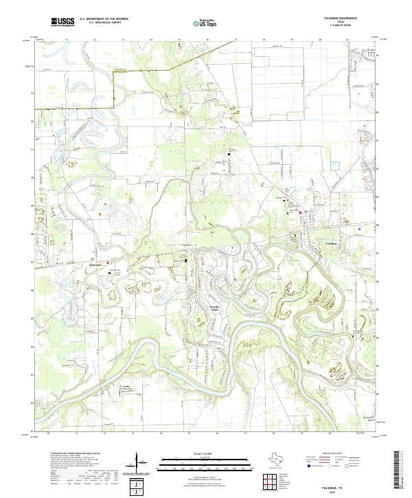
2022 Map of Fulshear
USGS Topo · Published 2022About this map
The Brazos River meanders through this portion of Fort Bend County, creating a complex geography of oxbows and alluvial plains. The landscape is defined by the development of Weston Lakes and Simonton, alongside the established community of Fulshear. The area’s history is preserved in its numerous small burial grounds, including the Fulshear Spanish Community Cem, Fulshear Black Cem, and the Bains Family Cem, reflecting a diverse social heritage. Terrain features such as Pool Hill and the Huntington Mound provide prominent landmarks above the river bottomlands. This 2022 survey captures the modern road network, from FM 1093 RD to FM 1489, showing the transition of this region from agricultural river land to a suburban corridor while maintaining proximity to the White Wing Ranch Airport and the winding course of Bessies Creek.
Find a feature on this map
134 named features on this map. Tap any name to fly to it.
Don’t see what you’re looking for? This feature index may not catch every label — zoom into the map to look around manually.
Map Details
Editions of this 2022 Fulshear Map
This is the sole edition of this map. No revisions or reprints were ever made.
Other maps of this area

1915 · Katy
USGS Topo · 1:24,000

1950 · Houston
USGS Topo · 1:250,000

1953 · Seguin
USGS Topo · 1:250,000

1955 · Brookshire
USGS Topo · 1:62,500

1955 · Richmond
USGS Topo · 1:62,500

1956 · Sealy
USGS Topo · 1:62,500

1956 · Wallis
USGS Topo · 1:62,500

1956 · Houston
USGS Topo · 1:250,000

1958 · Seguin
USGS Topo · 1:250,000

1960 · Wallis
USGS Topo · 1:24,000