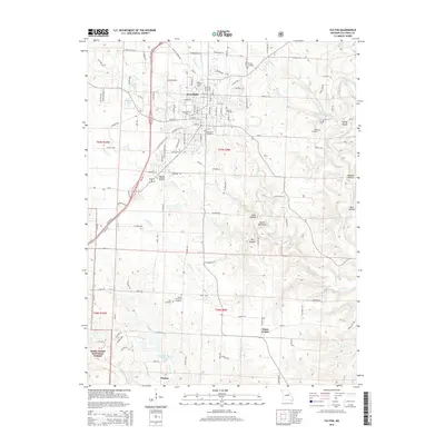
2015 Map of Fulton
USGS Topo · Published 2015About this map
The educational and civic center of Fulton is prominently detailed in this 2015 survey, featuring the campuses of William Woods Univ and Westminster Coll. The town's grid extends southward toward the Southside Cemetery, while the northern outskirts are marked by Hillcrest Cemetery and Dunlap Cemetery. The landscape transitions from the urban center into the surrounding Missouri countryside, where the drainage of Stinson Cr and Rockhouse Cr carves through the terrain. To the south, the small settlement of Hams Prairie sits amidst a network of rural roads and family cemeteries, including the United Brethren Cemetery and Muir Cemetery.
Find a feature on this map
133 named features on this map. Tap any name to fly to it.
Don’t see what you’re looking for? This feature index may not catch every label — zoom into the map to look around manually.
Map Details
Editions of this 2015 Fulton Map
This is the sole edition of this map. No revisions or reprints were ever made.
Other maps of this area

1886 · Jefferson City
USGS Topo · 1:125,000

1890 · Fulton
USGS Topo · 1:125,000

1894 · Jefferson City
USGS Topo · 1:125,000

1928 · Fulton
USGS Topo · 1:62,500

1931 · Fulton
USGS Topo · 1:62,500

1939 · Jefferson City
USGS Topo · 1:62,500

1942 · Jefferson City
USGS Topo · 1:62,500

1944 · Millersburg
USGS Topo · 1:62,500

1945 · Mokane
USGS Topo · 1:62,500

1946 · Millersburg
USGS Topo · 1:62,500