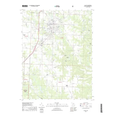
2017 Map of Fulton
USGS Topo · Published 2017About this map
Fulton serves as the academic and civic hub of this central Missouri landscape, home to the campus grounds of Westminster Coll and William Woods Univ. The city sits at the confluence of several small waterways, including Stinson Creek and Smith Br, which drain the surrounding agricultural uplands. South of the city, the terrain transitions into a more dissected landscape characterized by deep hollows like Dark Hollow and prominent ridges such as Devils Backbone. The southern reaches of the map include portions of the Mark Twain National Forest, where the topography drops toward the Middle River. Small rural settlements like Hams Prairie and Pitcher anchor the outlying areas, while numerous family and community burial grounds, such as Muir Cem and the United Brethren Cem, provide essential data points for local genealogy and land-use history.
Find a feature on this map
157 named features on this map. Tap any name to fly to it.
Don’t see what you’re looking for? This feature index may not catch every label — zoom into the map to look around manually.
Map Details
Editions of this 2017 Fulton Map
This is the sole edition of this map. No revisions or reprints were ever made.
Other maps of this area

1886 · Jefferson City
USGS Topo · 1:125,000

1890 · Fulton
USGS Topo · 1:125,000

1894 · Jefferson City
USGS Topo · 1:125,000

1928 · Fulton
USGS Topo · 1:62,500

1931 · Fulton
USGS Topo · 1:62,500

1939 · Jefferson City
USGS Topo · 1:62,500

1942 · Jefferson City
USGS Topo · 1:62,500

1944 · Millersburg
USGS Topo · 1:62,500

1945 · Mokane
USGS Topo · 1:62,500

1946 · Millersburg
USGS Topo · 1:62,500