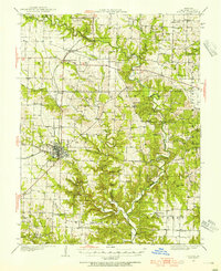
1928 Map of Fulton
USGS Topo · Published 1954About this map
Fulton serves as the central hub of this Callaway County landscape, where the Chicago and Alton railroad dictates the orientation of commerce and travel. The map captures a transitional era of Missouri’s rural education and worship, documenting dozens of neighborhood institutions like St James Sch and Old Auxvasse Ch that once anchored these agrarian townships. While the northern reaches around Kingdom City and McCredie are defined by more open terrain and rail access, the southern sections are deeply carved by drainage systems like Auxvasse Creek and Stinson Creek. These waterways created a network of named valleys, including Maddox Hollow and Spring Hollow, which constrained settlement patterns and influenced the placement of remote outposts such as Hams Prairie and Reform.
Find a feature on this map
61 named features on this map. Tap any name to fly to it.
Don’t see what you’re looking for? This feature index may not catch every label — zoom into the map to look around manually.
Map Details
Editions of this 1928 Fulton Map
2 editions found
Other maps of this area

1886 · Jefferson City
USGS Topo · 1:125,000

1890 · Mexico
USGS Topo · 1:125,000

1890 · Moberly
USGS Topo · 1:125,000

1890 · Fulton
USGS Topo · 1:125,000

1894 · Jefferson City
USGS Topo · 1:125,000

1928 · Fulton
USGS Topo · 1:62,500

1931 · Fulton
USGS Topo · 1:62,500

1932 · Mexico
USGS Topo · 1:62,500

1935 · Morrison
USGS Topo · 1:48,000

1939 · Jefferson City
USGS Topo · 1:62,500