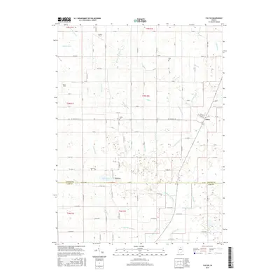
2016 Map of Fulton
USGS Topo · Published 2016About this map
Fulton stands at the eastern edge of this landscape, where the local road network converges near the Fulton Cem. The surrounding terrain is defined by an intricate system of drainage infrastructure, including the Studebaker Hiatt Ditch and Kern Neff Ditch, which manage the low-lying agricultural lands. To the west, the settlement of Fletcher is situated near Fletcher Lake, a significant water feature in an otherwise engineered hydraulic environment. The prevalence of family-named drainage projects like the Sylvester Maroney Ditch and Overmyer Ditch indicates a history of private and community land reclamation for farming. For those researching local families, the presence of several established burial grounds including Salem Cem, Smalley Cem, and Reed Cem provides specific points of interest across the rural townships.
Find a feature on this map
84 named features on this map. Tap any name to fly to it.
Don’t see what you’re looking for? This feature index may not catch every label — zoom into the map to look around manually.
Map Details
Editions of this 2016 Fulton Map
This is the sole edition of this map. No revisions or reprints were ever made.
Other maps of this area

1951 · Twelve Mile
USGS Topo · 1:24,000

1953 · Chicago
USGS Topo · 1:250,000

1953 · Danville
USGS Topo · 1:250,000

1955 · Danville
USGS Topo · 1:250,000

1955 · Logansport
USGS Topo · 1:24,000

1956 · Danville
USGS Topo · 1:250,000

1957 · Chicago
USGS Topo · 1:250,000

1960 · Lucerne
USGS Topo · 1:24,000

1960 · Fulton
USGS Topo · 1:24,000

1960 · Macy
USGS Topo · 1:24,000