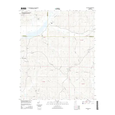
2015 Map of Fulton NE
USGS Topo · Published 2015About this map
Moores Mill sits near the intersection of the John Rankin Hwy and the tri-county boundary where Prentiss, Tishomingo, and Itawamba counties meet. This landscape is defined by its numerous small-scale family and community landmarks, particularly a high density of cemeteries such as Allen Cem, Mitchell Cem, and Locust Tree Cem. The terrain is deeply carved by a network of waterways, including Mackeys Cr, Red Bud Cr, and Saucer Cr, which flow through the undulating hills.
Find a feature on this map
71 named features on this map. Tap any name to fly to it.
Don’t see what you’re looking for? This feature index may not catch every label — zoom into the map to look around manually.
Map Details
Editions of this 2015 Fulton NE Map
This is the sole edition of this map. No revisions or reprints were ever made.
Other maps of this area

1936 · Belmont
USGS Topo · 1:24,000

1936 · Red Bay
USGS Topo · 1:24,000

1950 · Belmont
USGS Topo · 1:24,000

1951 · Red Bay
USGS Topo · 1:24,000
1951 · Belmont
USGS Topo · 1:24,000

1956 · Tupelo
USGS Topo · 1:250,000

1958 · Tupelo
USGS Topo · 1:250,000
1965 · Paden SE
USGS Topo · 1:24,000

1965 · Fulton SE
USGS Topo · 1:24,000

1965 · Fulton
USGS Topo · 1:24,000