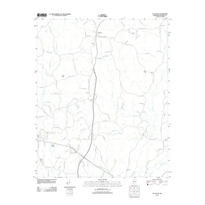
2012 Map of Fulton SE
USGS Topo · Published 2012About this map
Fairview and Clay anchor this portion of Itawamba County, where a dense network of country roads connects family burial grounds and small communities. The landscape is defined by the winding paths of Bull Mountain Cr and its many tributaries, including Gum Cr and Lick Skillet Cr. Genealogists will find an exceptional number of documented cemeteries throughout the area, ranging from Mount Gilead Cem to the Chamblee Cem further south. The Fairview Lookout Tower stands as a prominent landmark near the northern edge of the survey, while the Itawamba Memorial Gardens and Hardin Chapel suggest the long-standing spiritual and community centers of the region. This 2012 record preserves the placement of local homesteads and church-affiliated landmarks like East Fulton before further modern development altered the rural character of these Mississippi hills.
Find a feature on this map
117 named features on this map. Tap any name to fly to it.
Don’t see what you’re looking for? This feature index may not catch every label — zoom into the map to look around manually.
Map Details
Editions of this 2012 Fulton SE Map
This is the sole edition of this map. No revisions or reprints were ever made.
Other maps of this area

1936 · Red Bay
USGS Topo · 1:24,000

1951 · Red Bay
USGS Topo · 1:24,000

1956 · Tupelo
USGS Topo · 1:250,000

1958 · Tupelo
USGS Topo · 1:250,000

1965 · Fulton SE
USGS Topo · 1:24,000

1965 · Fulton
USGS Topo · 1:24,000
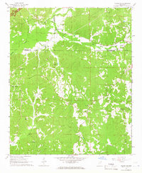
1965 · Fulton NE
USGS Topo · 1:24,000

1965 · Kirkville
USGS Topo · 1:24,000

1966 · Beans Ferry
USGS Topo · 1:24,000

1966 · Tremont
USGS Topo · 1:24,000