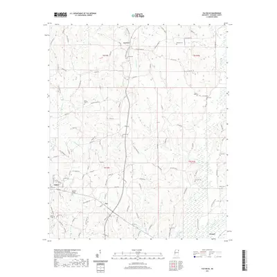
2021 Map of Fulton SE
USGS Topo · Published 2021About this map
Fulton and the rural communities of eastern Itawamba County are defined by a network of creeks and family-named roads that reveal the area's ancestral roots. The landscape is dominated by the drainage systems of Little Briar Cr, Gum Creek, and Bull Mountain Cr, which carve through the terrain. Numerous small burial grounds are scattered across the quadrangle, such as Benefield Cem and Palmetto Cem, indicating the decentralized settlement patterns common in this part of Mississippi.
Find a feature on this map
111 named features on this map. Tap any name to fly to it.
Don’t see what you’re looking for? This feature index may not catch every label — zoom into the map to look around manually.
Map Details
Editions of this 2021 Fulton SE Map
This is the sole edition of this map. No revisions or reprints were ever made.
Other maps of this area

1936 · Red Bay
USGS Topo · 1:24,000

1951 · Red Bay
USGS Topo · 1:24,000

1956 · Tupelo
USGS Topo · 1:250,000

1958 · Tupelo
USGS Topo · 1:250,000

1965 · Fulton SE
USGS Topo · 1:24,000

1965 · Fulton
USGS Topo · 1:24,000
1965 · Fulton NE
USGS Topo · 1:24,000

1965 · Kirkville
USGS Topo · 1:24,000

1966 · Beans Ferry
USGS Topo · 1:24,000

1966 · Tremont
USGS Topo · 1:24,000