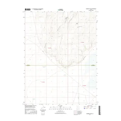
2017 Map of Fumarole Butte
USGS Topo · Published 2017About this map
Fumarole Butte dominates the volcanic landscape of this central Utah desert, located along the boundary between Juab and Millard Counties. The terrain is characterized by geothermal and hydrological features, including the unique ridge systems of Baker Hogs Back Left Fork and Baker Hogs Back Right Fork. Water management in this arid environment is evident through several named catchments like Swasey Hardpan Reservoir and Crater Reservoir, which serve the expansive flats south of Crater Bench. The map captures a transition from the basaltic highlands down to the salt flats of the Sevier Desert, where infrastructure is limited to routes such as Brush Hwy and the isolated Baker Hot Springs Rd.
Find a feature on this map
16 named features on this map. Tap any name to fly to it.
Don’t see what you’re looking for? This feature index may not catch every label — zoom into the map to look around manually.
Map Details
Editions of this 2017 Fumarole Butte Map
This is the sole edition of this map. No revisions or reprints were ever made.
Other maps of this area

1885 · Sevier Desert
USGS Topo · 1:250,000

1953 · Delta
USGS Topo · 1:250,000

1958 · Delta
USGS Topo · 1:250,000

1962 · Delta
USGS Topo · 1:250,000

1962 · Delta
USGS Topo · 1:62,500

1971 · Smelter Knolls East
USGS Topo · 1:24,000

1971 · Baker Hot Springs
USGS Topo · 1:24,000

1971 · Picture Rock Hills
USGS Topo · 1:24,000

1971 · Drum Mts Well
USGS Topo · 1:24,000

1971 · Crater Bench Reservoir
USGS Topo · 1:24,000