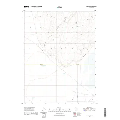
2020 Map of Fumarole Butte
USGS Topo · Published 2020About this map
Fumarole Butte rises as a prominent landmark in this desert landscape, located along the border where Juab and Millard counties meet. The terrain is defined by its arid hydrology, featuring catchment points such as Swasey Hardpan Reservoir, Crater Reservoir, and the isolated Whirlwind Reservoir. This 2020 survey illustrates a network of specialized access roads and trails, including the Baker Hogs Back Right Fork and Baker Hogs Back Left Fork, which navigate the elevation changes around Crater Bench. The presence of Baker Hogs Back Spr and the route toward Baker Hot Springs Rd suggests the geothermal and hydraulic importance of this specific sector of the Sevier Desert. The map captures a workspace of ranching and resource management, evidenced by the scattered reservoirs and the corridor of the Brush Hwy.
Find a feature on this map
12 named features on this map. Tap any name to fly to it.
Don’t see what you’re looking for? This feature index may not catch every label — zoom into the map to look around manually.
Map Details
Editions of this 2020 Fumarole Butte Map
This is the sole edition of this map. No revisions or reprints were ever made.
Other maps of this area

1885 · Sevier Desert
USGS Topo · 1:250,000

1953 · Delta
USGS Topo · 1:250,000

1958 · Delta
USGS Topo · 1:250,000

1962 · Delta
USGS Topo · 1:250,000

1962 · Delta
USGS Topo · 1:62,500

1971 · Smelter Knolls East
USGS Topo · 1:24,000

1971 · Baker Hot Springs
USGS Topo · 1:24,000

1971 · Picture Rock Hills
USGS Topo · 1:24,000

1971 · Drum Mts Well
USGS Topo · 1:24,000

1971 · Crater Bench Reservoir
USGS Topo · 1:24,000