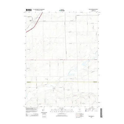
2015 Map of Funks Grove
USGS Topo · Published 2015About this map
Funks Grove serves as the primary landmark in this Central Illinois landscape, where the agricultural grid meets the wooded drainage of Timber Cr. The area is bisected by the historic corridor of Old Route 66, which runs parallel to the modern interstate, tracing the legacy of mid-century American travel. The land south of the McLean Co and De Witt Co border is defined by a dense network of waterways, including the winding path of Kickapoo Creek and its many tributaries like Short Point Cr and Long Point Cr.
Find a feature on this map
52 named features on this map. Tap any name to fly to it.
Don’t see what you’re looking for? This feature index may not catch every label — zoom into the map to look around manually.
Map Details
Editions of this 2015 Funks Grove Map
This is the sole edition of this map. No revisions or reprints were ever made.
Other maps of this area

1949 · Mc Lean
USGS Topo · 1:62,500

1951 · McLean
USGS Topo · 1:62,500

1951 · Le Roy
USGS Topo · 1:62,500

1957 · Kenney
USGS Topo · 1:62,500

1957 · Maroa
USGS Topo · 1:62,500

1958 · Peoria
USGS Topo · 1:250,000

1961 · Peoria
USGS Topo · 1:250,000

1963 · Peoria
USGS Topo · 1:250,000
1979 · Clinton
USGS Topo · 1:24,000
1980 · Waynesville East
USGS Topo · 1:24,000