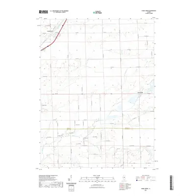
2021 Map of Funks Grove
USGS Topo · Published 2021About this map
Heyworth and Funks Grove anchor this Central Illinois landscape along the border of McLean and De Witt Counties. The area is defined by the drainage of Kickapoo Creek, which receives several local tributaries including Short Point Cr, Long Point Cr, and Timber Cr. These waterways carved the subtle relief that broke the surrounding prairie, providing the timber and drainage that influenced early settlement patterns.
Find a feature on this map
63 named features on this map. Tap any name to fly to it.
Don’t see what you’re looking for? This feature index may not catch every label — zoom into the map to look around manually.
Map Details
Editions of this 2021 Funks Grove Map
This is the sole edition of this map. No revisions or reprints were ever made.
Other maps of this area

1949 · Mc Lean
USGS Topo · 1:62,500

1951 · McLean
USGS Topo · 1:62,500

1951 · Le Roy
USGS Topo · 1:62,500

1957 · Kenney
USGS Topo · 1:62,500

1957 · Maroa
USGS Topo · 1:62,500

1958 · Peoria
USGS Topo · 1:250,000

1961 · Peoria
USGS Topo · 1:250,000

1963 · Peoria
USGS Topo · 1:250,000
1979 · Clinton
USGS Topo · 1:24,000
1980 · Waynesville East
USGS Topo · 1:24,000