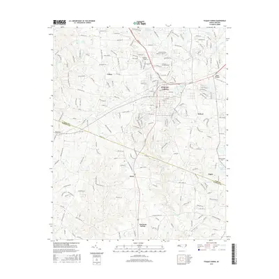
2016 Map of Fuquay-Varina
USGS Topo · Published 2016About this map
Fuquay-Varina serves as the central hub in this 2016 survey, where the expanding road network of the North Carolina Piedmont meets the historic boundaries of the Wake Co Harnett Co line. The map illustrates a landscape of established settlements and newer residential development, with Five Points and Wilbon marking the northern approaches to the town center. The presence of Greenlawn Memorial Gardens and numerous family-named landmarks like Ballentine Dairy provide significant touchpoints for local researchers.
Find a feature on this map
200 named features on this map. Tap any name to fly to it.
Don’t see what you’re looking for? This feature index may not catch every label — zoom into the map to look around manually.
Map Details
Editions of this 2016 Fuquay-Varina Map
This is the sole edition of this map. No revisions or reprints were ever made.
Other maps of this area

1953 · Raleigh
USGS Topo · 1:250,000

1954 · Raleigh
USGS Topo · 1:250,000

1964 · Lake Wheeler
USGS Topo · 1:24,000

1964 · Angier
USGS Topo · 1:24,000

1964 · Garner
USGS Topo · 1:62,500

1973 · Coats
USGS Topo · 1:24,000

1974 · Apex
USGS Topo · 1:24,000
1974 · Fuquay-Varina
USGS Topo · 1:24,000
1974 · New Hill
USGS Topo · 1:24,000

1974 · Mamers
USGS Topo · 1:24,000