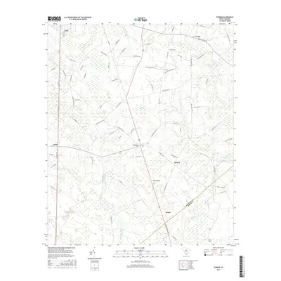
2017 Map of Furman
USGS Topo · Published 2017About this map
The town of Furman serves as the central hub of this South Carolina Lowcountry landscape, situated at the intersection of local routes in southern Hampton County. The map documents a transition from the structured street grids of Estill and Scotia to the more dispersed agricultural and wetland areas of Stafford and De Loach. Significant hydrological features like Black Swamp, Zigzag Branch, and Johnson Big Pond dominate the drainage patterns of the region, reflecting the low-lying, water-dense geography typical of this part of the state.
Find a feature on this map
77 named features on this map. Tap any name to fly to it.
Don’t see what you’re looking for? This feature index may not catch every label — zoom into the map to look around manually.
Map Details
Editions of this 2017 Furman Map
This is the sole edition of this map. No revisions or reprints were ever made.
Other maps of this area

1918 · Varnville
USGS Topo · 1:62,500

1919 · Pineland
USGS Topo · 1:62,500

1919 · Shirley
USGS Topo · 1:62,500

1920 · Peeples
USGS Topo · 1:62,500

1943 · Pineland
USGS Topo · 1:62,500

1943 · Peeples
USGS Topo · 1:62,500

1943 · Shirley
USGS Topo · 1:62,500

1944 · Varnville
USGS Topo · 1:62,500

1947 · Savannah
USGS Topo · 1:250,000

1948 · Savannah
USGS Topo · 1:250,000