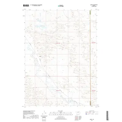
2017 Map of Gables
USGS Topo · Published 2017About this map
The settlement of Gables sits within a landscape defined by the winding course of Cedar Creek, tracing a path through the sand hills of northern Nebraska. This 2017 survey by the U.S. Geological Survey captures the quiet, rural character of the region, where the primary infrastructure consists of Cedar River Rd and the long, straight stretch of Dumas Ave marking the boundary of Garfield Co Wheeler Co. The terrain is marked by intricate contour patterns and seasonal wetlands, illustrating the unique drainage system of the Cedar Cr valley. Researchers can examine the public land survey system divisions, such as t23n r13w, which delineate the ranching and agricultural tracts that have structured this sparsely populated corner of Garfield County for generations.
Find a feature on this map
10 named features on this map. Tap any name to fly to it.
Don’t see what you’re looking for? This feature index may not catch every label — zoom into the map to look around manually.
Map Details
Editions of this 2017 Gables Map
This is the sole edition of this map. No revisions or reprints were ever made.
Other maps of this area

1954 · Gables SE
USGS Topo · 1:24,000

1954 · Gables SW
USGS Topo · 1:24,000

1954 · Gables NW
USGS Topo · 1:24,000

1954 · Bartlett NW
USGS Topo · 1:24,000

1954 · Ericson
USGS Topo · 1:24,000

1954 · Gables
USGS Topo · 1:24,000

1955 · Broken Bow
USGS Topo · 1:250,000

1955 · O'Neill
USGS Topo · 1:250,000

1956 · Broken Bow
USGS Topo · 1:250,000

1959 · O'Neill
USGS Topo · 1:250,000