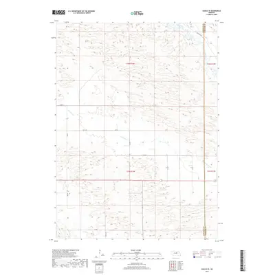
2017 Map of Gables SE
USGS Topo · Published 2017About this map
The Nebraska Sandhills define the topography of this Garfield and Wheeler County borderland. The landscape is characterized by its drainage network, particularly Cedar Creek in the northeast and the intermittent path of Dry Cedar Cr as it winds through the southern and western sections. Human activity is largely confined to a rectilinear grid of section roads and rural routes, reflecting the region's enduring ranching and agricultural patterns. These travel ways, including Cedar River Rd and Silver Rd, provide access through a terrain of low dunes and depressions. The boundary line between Garfield Co and Wheeler Co runs vertically through the eastern portion of the map, while Joint Loop and 827th Ave serve as primary connectors for the remote homesteads and grazing lands that dominate this quiet corner of the plains.
Find a feature on this map
14 named features on this map. Tap any name to fly to it.
Don’t see what you’re looking for? This feature index may not catch every label — zoom into the map to look around manually.
Map Details
Editions of this 2017 Gables SE Map
This is the sole edition of this map. No revisions or reprints were ever made.
Other maps of this area

1954 · Gables SE
USGS Topo · 1:24,000

1954 · Gables SW
USGS Topo · 1:24,000

1954 · Ord NE
USGS Topo · 1:24,000

1954 · Ord NW
USGS Topo · 1:24,000

1954 · Greeley NW
USGS Topo · 1:24,000

1954 · Gables NW
USGS Topo · 1:24,000

1954 · Bartlett NW
USGS Topo · 1:24,000

1954 · Ericson
USGS Topo · 1:24,000

1954 · Gables
USGS Topo · 1:24,000

1955 · Broken Bow
USGS Topo · 1:250,000