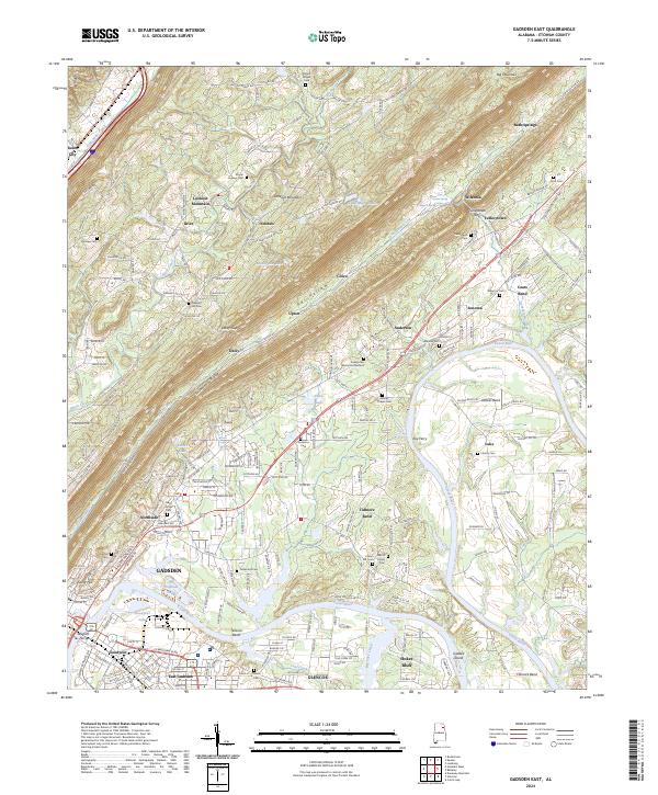
2024 Map of Gadsden East
USGS Topo · Published 2024About this map
Lookout Mountain and the prominent spine of Shinbone Ridge dominate the landscape of Etowah County, steering the course of the Coosa River as it winds through tight oxbows like Tidmore Bend and Tillisons Bend. This topography has long shaped the settlement patterns of northeast Alabama, where industrial centers like Gadsden and Glencoe contrast with the rural communities established along the ridge lines. In the valley, the Goodyear area reflects the region's manufacturing roots, situated near Goodyear Lake and the Ash Disposal Pond.
Find a feature on this map
249 named features on this map. Tap any name to fly to it.
Don’t see what you’re looking for? This feature index may not catch every label — zoom into the map to look around manually.
Map Details
Editions of this 2024 Gadsden East Map
This is the sole edition of this map. No revisions or reprints were ever made.
Other maps of this area

1885 · Gadsden
USGS Topo · 1:125,000

1888 · Gadsden
USGS Topo · 1:125,000

1889 · Springville
USGS Topo · 1:125,000

1892 · Springville
USGS Topo · 1:125,000

1892 · Gadsden
USGS Topo · 1:125,000

1893 · Fort Payne
USGS Topo · 1:125,000

1895 · Gadsden
USGS Topo · 1:125,000

1898 · Fort Payne
USGS Topo · 1:125,000

1900 · Fort Payne
USGS Topo · 1:125,000

1900 · Anniston
USGS Topo · 1:125,000