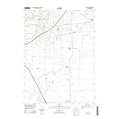
2013 Map of Gageville
USGS Topo · Published 2013About this map
The Ashtabula River carves a winding path through this northern Ohio landscape, defining the rural character of Jefferson and Sheffield Townships. Small, historic crossroads like Gageville, Sheffield Center, and Ollins Corners anchor the local road network, which is bridged by structures such as the Benetka Road Bridge and the Olin-Dewey Road Bridge. The area maintains a strong agricultural identity, evidenced by the presence of the Plymouth Pines Alpaca Farm, Maple View Farm, and the Hidden Creek Dairy Farm.
Find a feature on this map
71 named features on this map. Tap any name to fly to it.
Don’t see what you’re looking for? This feature index may not catch every label — zoom into the map to look around manually.
Map Details
Editions of this 2013 Gageville Map
This is the sole edition of this map. No revisions or reprints were ever made.
Other maps of this area

1905 · Andover
USGS Topo · 1:48,000

1905 · Ashtabula
USGS Topo · 1:62,500

1905 · Jefferson
USGS Topo · 1:62,500

1906 · Conneaut
USGS Topo · 1:62,500

1907 · Andover
USGS Topo · 1:62,500

1907 · Jefferson
USGS Topo · 1:62,500

1950 · Cleveland
USGS Topo · 1:250,000

1956 · Cleveland
USGS Topo · 1:250,000

1959 · Dorset
USGS Topo · 1:24,000
1959 · Leon
USGS Topo · 1:24,000