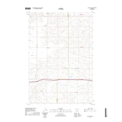
2020 Map of Gails Coulee
USGS Topo · Published 2020About this map
Yellowstone County and Big Horn County meet along a sharp longitudinal divide in this section of the Montana plains. The landscape is defined by a network of drainage systems, most notably Tenmile Cr and Alkali Cr, which carve through the undulating terrain. Significant geographical depressions like Gails Coulee and Barley Coulee provide distinct landmarks in a region largely shaped by its hydrological patterns. Transportation across this rural expanse is facilitated by established routes such as Indian Creek Rd and Milam Rd, which traverse the high ground between the various creek beds. The map illustrates the structured township and range system at work, providing a clear view of the territorial divisions across t1n r29e and adjacent sections just as they appeared in recent years.
Find a feature on this map
16 named features on this map. Tap any name to fly to it.
Don’t see what you’re looking for? This feature index may not catch every label — zoom into the map to look around manually.
Map Details
Editions of this 2020 Gails Coulee Map
This is the sole edition of this map. No revisions or reprints were ever made.
Other maps of this area

1893 · Huntley
USGS Topo · 1:125,000

1894 · Fort Custer
USGS Topo · 1:125,000

1954 · Billings
USGS Topo · 1:250,000

1954 · Hardin
USGS Topo · 1:250,000

1957 · Hardin
USGS Topo · 1:250,000

1957 · Billings
USGS Topo · 1:250,000

1958 · Billings
USGS Topo · 1:250,000

1958 · Hardin
USGS Topo · 1:250,000

1967 · Nibbe
USGS Topo · 1:24,000

1967 · Worden
USGS Topo · 1:24,000