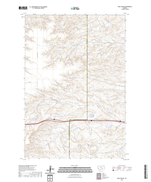
2024 Map of Gails Coulee
USGS Topo · Published 2024About this map
Tenmile Creek and Alkali Creek define the drainage patterns of this Montana landscape on the border of Yellowstone and Big Horn Counties. The terrain is marked by distinct erosional features typical of the region, including Barley Coulee and the central drainage of Gails Coulee. While the area remains largely rural and undeveloped, the grid of section lines and the presence of thoroughfares like Indian Creek Rd and Milam Rd indicate the established grazing and agricultural land divisions that have persisted for generations. Surveyed in the early 21st century, the map provides a clear view of the water sources such as Spring Creek and Hay Creek which are critical to the local geography. The county boundary itself cuts north to south through the center of the sheet, providing a precise reference for those researching property lines or local jurisdictional history.
Find a feature on this map
16 named features on this map. Tap any name to fly to it.
Don’t see what you’re looking for? This feature index may not catch every label — zoom into the map to look around manually.
Map Details
Editions of this 2024 Gails Coulee Map
This is the sole edition of this map. No revisions or reprints were ever made.
Other maps of this area

1893 · Huntley
USGS Topo · 1:125,000

1894 · Fort Custer
USGS Topo · 1:125,000

1954 · Billings
USGS Topo · 1:250,000

1954 · Hardin
USGS Topo · 1:250,000

1957 · Hardin
USGS Topo · 1:250,000

1957 · Billings
USGS Topo · 1:250,000

1958 · Billings
USGS Topo · 1:250,000

1958 · Hardin
USGS Topo · 1:250,000

1967 · Nibbe
USGS Topo · 1:24,000

1967 · Worden
USGS Topo · 1:24,000