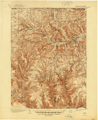
1900 Map of Gaines
USGS Topo · Published 1944About this map
The Cowanesque River valley serves as the primary corridor for commerce and settlement in this 1900 survey of the northern tier of Pennsylvania. The New York Central and Hudson River RR follows the river through Harrison Valley and Westfield, highlighting the era's dependence on rail for moving timber and agricultural goods. To the south, the Buffalo and Susquehanna Railroad winds through the narrow valleys of West Pike and Gaines along Pine Creek. The landscape is defined by its deep hollows and family-named landmarks like Stiles Hill and Leech Hill. Smaller farming hamlets such as Loucks Mills and Sunderlinville are connected by a dense network of mountain roads, while the Pennsylvania New York Boundary Line marks the northern edge of the sheet near Whites Corners.
Find a feature on this map
62 named features on this map. Tap any name to fly to it.
Don’t see what you’re looking for? This feature index may not catch every label — zoom into the map to look around manually.
Map Details
Editions of this 1900 Gaines Map
5 editions found
Other maps of this area

1899 · Gaines
USGS Topo · 1:62,500

1900 · Gaines
USGS Topo · 1:62,500

1900 · Elkland
USGS Topo · 1:62,500

1924 · Woodhull
USGS Topo · 1:48,000

1926 · Wellsville
USGS Topo · 1:62,500

1926 · Woodhull
USGS Topo · 1:62,500

1926 · Greenwood
USGS Topo · 1:62,500

1932 · Genesee
USGS Topo · 1:62,500

1937 · Genesee
USGS Topo · 1:62,500

1944 · Woodhull
USGS Topo · 1:62,500