
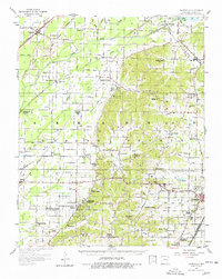
1958 Map of Gainesville
USGS Topo · Published 1962About this map
Jones Ridge provides the topographic backbone for this Greene County landscape, where the lowlands of the Cache River meet the rising ground of Crowleys Ridge State Park. The map documents a dense network of mid-century rural institutions, including dozens of country churches and schools such as Evening Star Ch, Pruitt Ch, and Green Grove Sch. These landmarks, along with family-named burial grounds like Jones Ridge Cem and Bonds Cem, offer a detailed view of the social fabric of settlements like Stanford, Walcott, and Beech Grove. Transportation patterns are anchored by the Missouri Pacific and St Louis Southwestern railroads, which served the regional hub of Paragould. Of particular note is the Emergency Landing Field (Abandoned) near Walcott, a remnant of mid-century aviation history alongside the more modern Municipal Airport near the county seat.
Find a feature on this map
67 named features on this map. Tap any name to fly to it.
Don’t see what you’re looking for? This feature index may not catch every label — zoom into the map to look around manually.
Map Details
Editions of this 1958 Gainesville Map
2 editions found
Other maps of this area

1932 · Walnut Ridge
USGS Topo · 1:62,500

1935 · Sedgwick
USGS Topo · 1:62,500

1935 · Rector
USGS Topo · 1:62,500

1935 · Knobel
USGS Topo · 1:62,500

1935 · Reyno
USGS Topo · 1:62,500

1935 · Walnut Ridge
USGS Topo · 1:62,500

1939 · Jonesboro
USGS Topo · 1:62,500

1940 · Gainesville
USGS Topo · 1:62,500

1940 · Marmaduke
USGS Topo · 1:62,500

1941 · Leachville
USGS Topo · 1:62,500