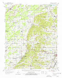
1958 Map of Gainesville
USGS Topo · Published 1978About this map
Crowleys Ridge State Park and the rugged topography of the ridge itself divide this landscape between the alluvial bottomlands of the Cache River and the expanding city of Paragould. During the late 1950s, this area of Greene County maintained a dense network of rural infrastructure, from the Missouri Pacific railroad serving Delaplaine to numerous small congregations such as Stanford Ch and Warren Chapel. The transition from the flat, ditch-drained agricultural lands in the west to the higher elevations of the ridge is marked by local landmarks like Jones Ridge and an Emergency Landing Field (Abandoned) near Walcott. Dozens of family-named burial grounds, including Jones Ridge Cem and Morrow Cem, provide valuable points of interest for genealogists tracing the early settlement patterns of the region.
Find a feature on this map
68 named features on this map. Tap any name to fly to it.
Don’t see what you’re looking for? This feature index may not catch every label — zoom into the map to look around manually.
Map Details
Editions of this 1958 Gainesville Map
2 editions found

Other maps of this area

1932 · Walnut Ridge
USGS Topo · 1:62,500

1935 · Sedgwick
USGS Topo · 1:62,500

1935 · Rector
USGS Topo · 1:62,500

1935 · Knobel
USGS Topo · 1:62,500

1935 · Reyno
USGS Topo · 1:62,500

1935 · Walnut Ridge
USGS Topo · 1:62,500

1939 · Jonesboro
USGS Topo · 1:62,500

1940 · Gainesville
USGS Topo · 1:62,500

1940 · Marmaduke
USGS Topo · 1:62,500

1941 · Leachville
USGS Topo · 1:62,500