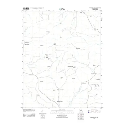
2012 Map of Gainesville NW
USGS Topo · Published 2012About this map
Brixey sits near the northern boundary of this Ozark County landscape, where the terrain is defined by a dense network of high ridges and hollows carved by the Barren Fork and Caney Creek. Local history is preserved in small family and community landmarks like Sheppard Cemetery and Brushy Knob Cemetery, while the presence of Romance Lookout Tower atop a ridge highlights the area's forest management legacy. The topography is notably marked by distinctive peaks such as Tater Cave Mountain, Bear Cave Mountain, and High Rock Mountain, which overlook deep valleys including Stillhouse Hollow and Board Hollow. This complex drainage system, featuring Lick Creek and Becky Cobb Creek, illustrates a traditional Ozark settlement pattern where travel and dwellings were dictated by the narrow valley floors and the steep, named balds and knobs like Ludecker Bald and Glade Knob.
Find a feature on this map
75 named features on this map. Tap any name to fly to it.
Don’t see what you’re looking for? This feature index may not catch every label — zoom into the map to look around manually.
Map Details
Editions of this 2012 Gainesville NW Map
This is the sole edition of this map. No revisions or reprints were ever made.
Other maps of this area

1934 · Gainesville
USGS Topo · 1:48,000

1936 · Thornfield
USGS Topo · 1:48,000

1936 · Ava
USGS Topo · 1:48,000

1937 · Buckhart
USGS Topo · 1:48,000

1940 · Gainesville
USGS Topo · 1:62,500

1942 · Ava
USGS Topo · 1:62,500

1943 · Thornfield
USGS Topo · 1:62,500

1943 · Buckhart
USGS Topo · 1:62,500

1945 · Ava
USGS Topo · 1:62,500

1945 · Harrison
USGS Topo · 1:250,000