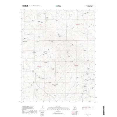
2017 Map of Gainesville NW
USGS Topo · Published 2017About this map
Sheppard Ridge and Preston Flat Ridge define the high ground of this Ozark County landscape, where deep hollows and creek drainages dictate the local navigation. The 2017 terrain is marked by numerous family-named landmarks such as Ludecker Bald, Glade Knob, and Tater Cave Mtn, reflecting the long-established settlement patterns of this Missouri region. Water is central to the area's layout, with Gardner Lake in the north and the winding course of Lick Creek cutting through the center. For genealogists and local historians, the placement of the Sheppard Cem and Brushy Knob Cemetery provides essential anchors for family research. Modern infrastructure appears in the form of the Rocky Top Airfield and a network of county roads that follow the ridges and valleys, including State Highway AA near Weidensaul Hollow.
Find a feature on this map
96 named features on this map. Tap any name to fly to it.
Don’t see what you’re looking for? This feature index may not catch every label — zoom into the map to look around manually.
Map Details
Editions of this 2017 Gainesville NW Map
This is the sole edition of this map. No revisions or reprints were ever made.
Other maps of this area

1934 · Gainesville
USGS Topo · 1:48,000

1936 · Thornfield
USGS Topo · 1:48,000

1936 · Ava
USGS Topo · 1:48,000

1937 · Buckhart
USGS Topo · 1:48,000

1940 · Gainesville
USGS Topo · 1:62,500

1942 · Ava
USGS Topo · 1:62,500

1943 · Thornfield
USGS Topo · 1:62,500

1943 · Buckhart
USGS Topo · 1:62,500

1945 · Ava
USGS Topo · 1:62,500

1945 · Harrison
USGS Topo · 1:250,000