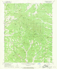
1968 Map of Gainesville NW
USGS Topo · Published 1970About this map
The Caney Mountain State Game Refuge dominates this section of the Ozarks, preserving a landscape defined by prominent peaks like Caney Mountain and Tater Cave Mountain. This 1968 survey captures the region's mid-century character, where isolated rural landmarks like the Romance Lookout Tower and Charcoal Ovens sit tucked within narrow hollows and along timbered ridges. The settlement pattern is largely dispersed, tied together by routes such as the Mailroute Road. Local genealogy is anchored by small country congregations and burial grounds, including the Pineview Ch and Brushy Knob Ch, alongside the Sheppard Cem and Loftis Cem. The intricate network of seasonal drainages, from Lick Creek to Barren Fork, underscores the difficult terrain that historically dictated the placement of smallholdings and family landmarks like Ludecker Bald and Stony Knob.
Find a feature on this map
67 named features on this map. Tap any name to fly to it.
Don’t see what you’re looking for? This feature index may not catch every label — zoom into the map to look around manually.
Map Details
Editions of this 1968 Gainesville NW Map
This is the sole edition of this map. No revisions or reprints were ever made.
Other maps of this area

1934 · Gainesville
USGS Topo · 1:48,000

1936 · Thornfield
USGS Topo · 1:48,000

1936 · Ava
USGS Topo · 1:48,000

1937 · Buckhart
USGS Topo · 1:48,000

1940 · Gainesville
USGS Topo · 1:62,500

1942 · Ava
USGS Topo · 1:62,500

1943 · Thornfield
USGS Topo · 1:62,500

1943 · Buckhart
USGS Topo · 1:62,500

1945 · Ava
USGS Topo · 1:62,500

1945 · Harrison
USGS Topo · 1:250,000