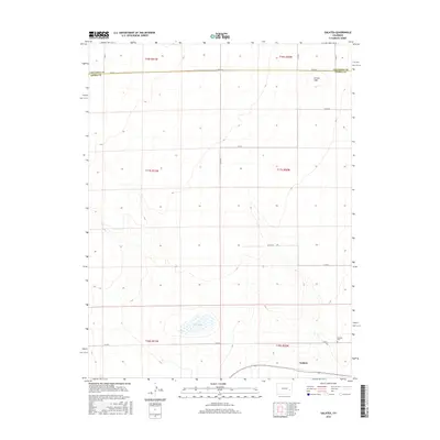
2016 Map of Galatea
USGS Topo · Published 2016About this map
Galatea occupies the southeastern reaches of this high plains landscape, situated just north of the border between Cheyenne Co and Kiowa Co. The settlement's history is physically anchored by the Galatea Cem, located along Co Rd U. This arid terrain is defined by its section-line road network, including major routes like Co Rd A and Co Rd 9, which slice through the township and range divisions of t17s r50w and t18s r50w.
Find a feature on this map
21 named features on this map. Tap any name to fly to it.
Don’t see what you’re looking for? This feature index may not catch every label — zoom into the map to look around manually.
Map Details
Editions of this 2016 Galatea Map
This is the sole edition of this map. No revisions or reprints were ever made.
Other maps of this area

1891 · Arroyo
USGS Topo · 1:125,000

1891 · Kit Carson
USGS Topo · 1:125,000

1891 · Las Animas
USGS Topo · 1:125,000

1892 · Lamar
USGS Topo · 1:125,000

1893 · Arroyo
USGS Topo · 1:125,000

1893 · Kit Carson
USGS Topo · 1:125,000

1893 · Las Animas
USGS Topo · 1:125,000

1954 · Lamar
USGS Topo · 1:250,000

1958 · Lamar
USGS Topo · 1:250,000

1968 · Hawkins
USGS Topo · 1:24,000