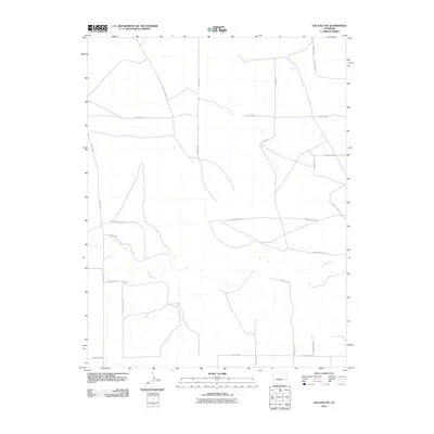
2010 Map of Galatea NE
USGS Topo · Published 2010About this map
Rush Creek meanders through the arid expanse of eastern Colorado, defining the primary drainage for this segment of the High Plains. The landscape is organized by a strict geometric grid of section lines, evidenced by a network of rural thoroughfares such as County Road J and County Road B. This system of roads reflects the agricultural and ranching heritage of the region, where wide-open spaces are partitioned for livestock and dryland farming. The map illustrates a contemporary view of the topography, showing subtle elevation changes and seasonal watercourses like County Road E and County Road D that cross the prairie. For those interested in the infrastructure of the American West, the reliance on these numbered and lettered county routes highlights the isolation and the necessary connectivity of modern rural Cheyenne County.
Find a feature on this map
16 named features on this map. Tap any name to fly to it.
Don’t see what you’re looking for? This feature index may not catch every label — zoom into the map to look around manually.
Map Details
Editions of this 2010 Galatea NE Map
This is the sole edition of this map. No revisions or reprints were ever made.
Other maps of this area

1891 · Arroyo
USGS Topo · 1:125,000

1891 · Kit Carson
USGS Topo · 1:125,000

1893 · Arroyo
USGS Topo · 1:125,000

1893 · Kit Carson
USGS Topo · 1:125,000

1954 · Lamar
USGS Topo · 1:250,000

1958 · Lamar
USGS Topo · 1:250,000

1978 · Galatea NE
USGS Topo · 1:24,000

1978 · Aroya
USGS Topo · 1:24,000
1978 · Galatea SW
USGS Topo · 1:24,000

1978 · Stacy Lakes Draw
USGS Topo · 1:24,000