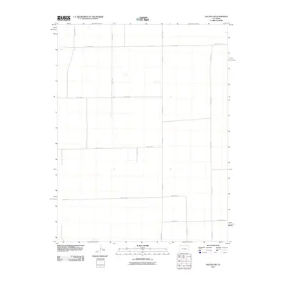
2010 Map of Galatea SW
USGS Topo · Published 2010About this map
Agricultural lands in the High Plains of Cheyenne County define this landscape, as documented in 2010. The terrain is organized by a precise grid of rural thoroughfares, with County Hwy G and County Road BB serving as primary east-west conduits across the northern reaches. This section of eastern Colorado illustrates the expansive township and range survey system, where north-south routes like County Hwy 45 and County RD 63 connect isolated farmsteads and ranchlands. The map reveals the meticulous division of the plains, showing the intersections of County Road E and County Road C as they cross the open country. These roads are the lifeblood of the local ranching economy, providing the only structured access across the vast, undulating prairie surface.
Find a feature on this map
15 named features on this map. Tap any name to fly to it.
Don’t see what you’re looking for? This feature index may not catch every label — zoom into the map to look around manually.
Map Details
Editions of this 2010 Galatea SW Map
This is the sole edition of this map. No revisions or reprints were ever made.
Other maps of this area

1891 · Arroyo
USGS Topo · 1:125,000

1891 · Las Animas
USGS Topo · 1:125,000

1893 · Arroyo
USGS Topo · 1:125,000

1893 · Las Animas
USGS Topo · 1:125,000

1954 · Lamar
USGS Topo · 1:250,000

1958 · Lamar
USGS Topo · 1:250,000

1974 · Haswell
USGS Topo · 1:24,000

1974 · Arlington NE
USGS Topo · 1:24,000

1978 · Galatea NE
USGS Topo · 1:24,000
1978 · Haswell NE
USGS Topo · 1:24,000