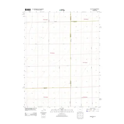
2013 Map of Galatea SW
USGS Topo · Published 2013About this map
Lincoln, Cheyenne, and Kiowa counties meet in this high-plains landscape where the grid of the Public Land Survey System dictates the modern transportation network. Unlike more populated regions, the geography here is defined almost entirely by its section lines and long-distance county roads. CO Highway G and CO Road BB serve as primary east-west corridors, while CO Road 63 and CO Road 19 trace the north-south boundaries between neighboring jurisdictions. The map reveals a land divided into large-scale townships such as t017s r052w and t017s r051w, reflecting the expansive agricultural and ranching tracts of eastern Colorado. This 2013 survey provides a clear view of the sparse infrastructure and the precise county lines that separate Lincoln, Cheyenne, and Kiowa counties, making it a valuable tool for researchers tracking property boundaries or historical land use in this specific corner of the state.
Find a feature on this map
23 named features on this map. Tap any name to fly to it.
Don’t see what you’re looking for? This feature index may not catch every label — zoom into the map to look around manually.
Map Details
Editions of this 2013 Galatea SW Map
This is the sole edition of this map. No revisions or reprints were ever made.
Other maps of this area

1891 · Arroyo
USGS Topo · 1:125,000

1891 · Las Animas
USGS Topo · 1:125,000

1893 · Arroyo
USGS Topo · 1:125,000

1893 · Las Animas
USGS Topo · 1:125,000

1954 · Lamar
USGS Topo · 1:250,000

1958 · Lamar
USGS Topo · 1:250,000

1974 · Haswell
USGS Topo · 1:24,000

1974 · Arlington NE
USGS Topo · 1:24,000

1978 · Galatea NE
USGS Topo · 1:24,000
1978 · Haswell NE
USGS Topo · 1:24,000