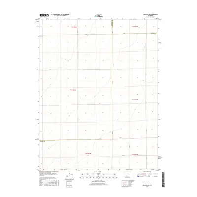
2016 Map of Galatea SW
USGS Topo · Published 2016About this map
The High Plains of Eastern Colorado converge at a rare tri-county juncture where Lincoln County, Cheyenne County, and Kiowa County meet. This 2016 survey illustrates the strict rectilinear organization of the Public Land Survey System, showing how the landscape is divided into townships such as t17s r52w and t16s r51w. The terrain is defined by its extreme isolation and the sparse network of gravel roads that follow section lines, including CO Rd 49 and CO Rd G. This area remains largely undeveloped, characterized by wide-open grazing land and subtle topographical depressions. It serves as a clear example of the rural infrastructure required to manage the vast agricultural reaches of the Colorado prairie, where transportation is limited to essential connectors like CO Rd 21 and CO Rd C.
Find a feature on this map
19 named features on this map. Tap any name to fly to it.
Don’t see what you’re looking for? This feature index may not catch every label — zoom into the map to look around manually.
Map Details
Editions of this 2016 Galatea SW Map
This is the sole edition of this map. No revisions or reprints were ever made.
Other maps of this area

1891 · Arroyo
USGS Topo · 1:125,000

1891 · Las Animas
USGS Topo · 1:125,000

1893 · Arroyo
USGS Topo · 1:125,000

1893 · Las Animas
USGS Topo · 1:125,000

1954 · Lamar
USGS Topo · 1:250,000

1958 · Lamar
USGS Topo · 1:250,000

1974 · Haswell
USGS Topo · 1:24,000

1974 · Arlington NE
USGS Topo · 1:24,000

1978 · Galatea NE
USGS Topo · 1:24,000
1978 · Haswell NE
USGS Topo · 1:24,000