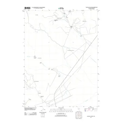
2011 Map of Galena Canyon
USGS Topo · Published 2011About this map
Buckingham Camp and the historic Wilson Ranch anchor this landscape in Lander County, showing the intersection of high-desert ranching and the area's mining legacy. The terrain is defined by a series of steep drainages, including Philadelphia Canyon and Galena Canyon, which lead toward the valley floor of the Reese River. This 2011 survey documents the persistent human footprint in a demanding environment, from the small settlement at Bannock to the industrial indicators of the Copper Basin and Little Giant Mill Creek in the north. Water remains the primary shaper of the land, with ephemeral flows like Duck Creek and Licking Creek cutting through the slopes of Chesser Mountain and Red Top Mountain. Researchers can trace the network of local roads that connect these remote outposts across the Great Basin.
Find a feature on this map
27 named features on this map. Tap any name to fly to it.
Don’t see what you’re looking for? This feature index may not catch every label — zoom into the map to look around manually.
Map Details
Editions of this 2011 Galena Canyon Map
This is the sole edition of this map. No revisions or reprints were ever made.
Other maps of this area

1932 · Sonoma Range
USGS Topo · 1:250,000

1939 · Sonoma Range
USGS Topo · 1:250,000

1940 · Antler Peak
USGS Topo · 1:62,500

1943 · Antler Peak
USGS Topo · 1:62,500

1949 · Mt. Lewis
USGS Topo · 1:62,500

1950 · Mt. Lewis
USGS Topo · 1:62,500

1955 · Winnemucca
USGS Topo · 1:250,000

1957 · Battle Mountain
USGS Topo · 1:62,500

1958 · Winnemucca
USGS Topo · 1:250,000

1961 · McCoy
USGS Topo · 1:62,500