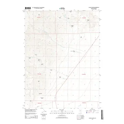
2014 Map of Galena Canyon
USGS Topo · Published 2014About this map
Bannock stands as a primary point of interest in this high-elevation landscape of the Battle Mountain range, where steep canyons and prominent peaks dominate the terrain. The map detail reflects a history of resource extraction, centered around the Copper Basin and the winding Little Giant Mill Cr near Red Top Mtn. To the south, the terrain falls away toward the Reese River valley, though the map's focus remains on the series of deeply incised drainages like Galena Canyon, Philadelphia Canyon, and Box Canyon. These natural corridors provided the primary access routes for prospectors and ranchers alike. Significant landmarks such as Chesser Mtn and Elephant Head provide clear navigational markers across the rugged public land survey system grid, which organizes the vast reaches of t31n r43e and its neighboring townships.
Find a feature on this map
32 named features on this map. Tap any name to fly to it.
Don’t see what you’re looking for? This feature index may not catch every label — zoom into the map to look around manually.
Map Details
Editions of this 2014 Galena Canyon Map
This is the sole edition of this map. No revisions or reprints were ever made.
Other maps of this area

1932 · Sonoma Range
USGS Topo · 1:250,000

1939 · Sonoma Range
USGS Topo · 1:250,000

1940 · Antler Peak
USGS Topo · 1:62,500

1943 · Antler Peak
USGS Topo · 1:62,500

1949 · Mt. Lewis
USGS Topo · 1:62,500

1950 · Mt. Lewis
USGS Topo · 1:62,500

1955 · Winnemucca
USGS Topo · 1:250,000

1957 · Battle Mountain
USGS Topo · 1:62,500

1958 · Winnemucca
USGS Topo · 1:250,000

1961 · McCoy
USGS Topo · 1:62,500