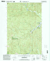
1996 Map of Galena Point
USGS Topo · Published 1999About this map
Kaniksu National Forest defines this high-altitude landscape along the border of Washington and Idaho. Revised in the mid-1990s, the map reveals a rugged drainage network where the Upper West Branch Priest River and Lower West Branch Priest River carve through the deep timber of the Selkirk Mountains. The topography is dominated by the massive Pelke Divide, which separates northern drainages like Squaw Valley from the Goose Creek system to the south. Notable elevations such as Galena Point and Goose Creek Point overlook these drainages, providing orientation for those tracking old forest trails and logging routes. The eastern edge of the quadrangle opens into the broad, low-lying expanse of Big Meadows, a distinct contrast to the steep canyons formed by Consalus Creek and Blickensderfer Creek.
Find a feature on this map
19 named features on this map. Tap any name to fly to it.
Don’t see what you’re looking for? This feature index may not catch every label — zoom into the map to look around manually.
Map Details
Editions of this 1996 Galena Point Map
This is the sole edition of this map. No revisions or reprints were ever made.
Other maps of this area

1901 · Sandpoint
USGS Topo · 1:125,000

1911 · Priest Lake
USGS Topo · 1:250,000

1911 · Sandpoint
USGS Topo · 1:125,000

1913 · Priest Lake
USGS Topo · 1:250,000

1934 · Metaline
USGS Topo · 1:125,000

1936 · Newport
USGS Topo · 1:96,000

1942 · Metaline
USGS Topo · 1:125,000

1942 · Newport
USGS Topo · 1:125,000

1958 · Sandpoint
USGS Topo · 1:250,000

1963 · Sandpoint
USGS Topo · 1:250,000