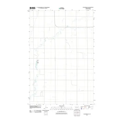
2011 Map of Galesburg SE
USGS Topo · Published 2011About this map
The Elm River meanders across this rural section of Traill County, North Dakota, defining the agricultural landscape with its complex, winding course. Water management infrastructure is evident along the river's path, specifically the Augustadt Dam and the Elm River Number 2 Dam. These features illustrate the vital role of water control in the Red River Valley, where the flat terrain requires careful stewardship of drainage and resources. The area is surveyed with a grid of rural roads, including primary corridors such as County Hwy-9 in the north and County Hwy-1 in the south, intersected by County Hwy No 14. This survey highlights the intersection of modern hydrological engineering and the established sectional road system characteristic of the Northern Plains.
Find a feature on this map
6 named features on this map. Tap any name to fly to it.
Don’t see what you’re looking for? This feature index may not catch every label — zoom into the map to look around manually.
Map Details
Editions of this 2011 Galesburg SE Map
This is the sole edition of this map. No revisions or reprints were ever made.
Other maps of this area

1918 · Kelso
USGS Topo · 1:62,500

1943 · Kelso
USGS Topo · 1:62,500

1952 · Grand Forks
USGS Topo · 1:250,000

1956 · Grand Forks
USGS Topo · 1:250,000

1966 · Grand Forks
USGS Topo · 1:250,000

1966 · Galesburg
USGS Topo · 1:24,000

1967 · Mayville South
USGS Topo · 1:24,000

1967 · Ayr NE
USGS Topo · 1:24,000

1967 · Blanchard
USGS Topo · 1:24,000

1967 · Ayr NW
USGS Topo · 1:24,000