
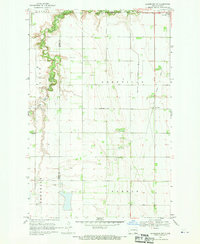
1966 Map of Galesburg
USGS Topo · Published 1968About this map
The Elm River meanders across this eastern North Dakota prairie, defining the agricultural landscape between the townships of Norman and Galesburg. During the mid-1960s, the Great Northern railroad served as the primary transport artery, connecting the small elevators and grid-patterned streets of Clifford and Galesburg. This survey captures the rural infrastructure of the era, from the various Gravel Pits supporting local road construction to the prominent Radio Tower standing near the Steele and Traill County line. Local heritage is preserved through the locations of the Clifford Cem and Elm River Cem, which serve as quiet landmarks for the surrounding farming communities. The map provides a precise look at the section-line roads and field boundaries that characterize the Red River Valley hinterlands.
Find a feature on this map
13 named features on this map. Tap any name to fly to it.
Don’t see what you’re looking for? This feature index may not catch every label — zoom into the map to look around manually.
Map Details
Editions of this 1966 Galesburg Map
This is the sole edition of this map. No revisions or reprints were ever made.
Other maps of this area

1952 · Grand Forks
USGS Topo · 1:250,000

1956 · Grand Forks
USGS Topo · 1:250,000

1966 · Grand Forks
USGS Topo · 1:250,000

1966 · Hope SE
USGS Topo · 1:24,000

1967 · Mayville South
USGS Topo · 1:24,000

1967 · Ayr NE
USGS Topo · 1:24,000

1967 · Ayr NW
USGS Topo · 1:24,000

1967 · Page
USGS Topo · 1:24,000

1968 · Hope NE
USGS Topo · 1:24,000
1968 · Galesburg
USGS Topo · 1:24,000