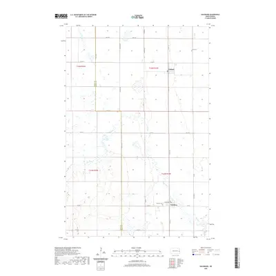
2020 Map of Galesburg
USGS Topo · Published 2020About this map
Galesburg and Clifford serve as the primary hubs of this agricultural landscape along the boundary of Steele and Traill counties. The terrain is defined by the winding course of the Elm River, which meanders through the southern and central portions of the quadrangle, influencing the layout of local sections and road networks. The map provides a contemporary record of these small communities, noting the grid of Dakota Ave in Galesburg and the northern position of Clifford. For genealogists and local historians, the sheet preserves the locations of established burial grounds, including the Elm River Cem situated just west of Galesburg and the Clifford Cem to the northeast of its namesake town. A robust network of county roads, such as Co Hwy 16 and Co Hwy 9, connects the various townships across this part of the Red River Valley region.
Find a feature on this map
25 named features on this map. Tap any name to fly to it.
Don’t see what you’re looking for? This feature index may not catch every label — zoom into the map to look around manually.
Map Details
Editions of this 2020 Galesburg Map
This is the sole edition of this map. No revisions or reprints were ever made.
Other maps of this area

1952 · Grand Forks
USGS Topo · 1:250,000

1956 · Grand Forks
USGS Topo · 1:250,000

1966 · Grand Forks
USGS Topo · 1:250,000

1966 · Galesburg
USGS Topo · 1:24,000

1966 · Hope SE
USGS Topo · 1:24,000

1967 · Mayville South
USGS Topo · 1:24,000

1967 · Ayr NE
USGS Topo · 1:24,000

1967 · Ayr NW
USGS Topo · 1:24,000

1967 · Page
USGS Topo · 1:24,000

1968 · Hope NE
USGS Topo · 1:24,000