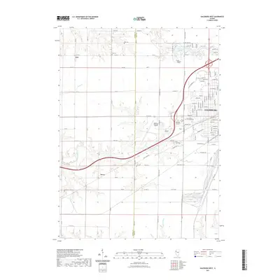
2021 Map of Galesburg West
USGS Topo · Published 2021About this map
Galesburg serves as the primary urban center for this portion of Knox County, characterized by a transition from dense residential grids to expansive prairie farmlands. The western outskirts are anchored by Carl Sandburg College and the Galesburg Municipal Airport, while the northern edge is defined by the recreational waters of Lake Storey. This modern survey reveals a landscape deeply intertwined with its history, as evidenced by the numerous burial grounds and small communities like Utah and Surrey that dot the countryside.
Find a feature on this map
77 named features on this map. Tap any name to fly to it.
Don’t see what you’re looking for? This feature index may not catch every label — zoom into the map to look around manually.
Map Details
Editions of this 2021 Galesburg West Map
This is the sole edition of this map. No revisions or reprints were ever made.
Other maps of this area

1921 · Monmouth
USGS Topo · 1:62,500

1923 · Monmouth
USGS Topo · 1:62,500

1923 · Alexis
USGS Topo · 1:62,500

1925 · Alexis
USGS Topo · 1:62,500

1925 · Galesburg
USGS Topo · 1:62,500

1927 · Galesburg
USGS Topo · 1:62,500

1947 · Woodhull
USGS Topo · 1:62,500

1958 · Burlington
USGS Topo · 1:250,000

1958 · Davenport
USGS Topo · 1:250,000

1961 · Burlington
USGS Topo · 1:250,000