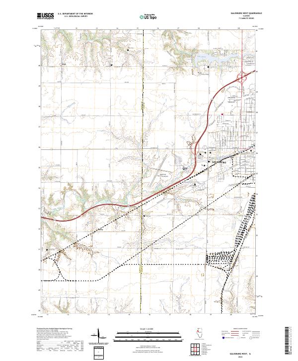
2024 Map of Galesburg West
USGS Topo · Published 2024About this map
The western reaches of Galesburg serve as a focal point where urban expansion meets the agricultural landscape of Western Illinois. This territory is notably dense with commemorative and institutional landmarks, including Carl Sandburg College and the Galesburg Municipal Airport. The map highlights a significant concentration of burial sites, ranging from the large Linwood Cem and East Linwood and Linwood Cem complex to smaller, family-named plots like Miles Cem and Horney Cem, offering substantial value for genealogical research in Knox County.
Find a feature on this map
51 named features on this map. Tap any name to fly to it.
Don’t see what you’re looking for? This feature index may not catch every label — zoom into the map to look around manually.
Map Details
Editions of this 2024 Galesburg West Map
This is the sole edition of this map. No revisions or reprints were ever made.
Other maps of this area

1921 · Monmouth
USGS Topo · 1:62,500

1923 · Monmouth
USGS Topo · 1:62,500

1923 · Alexis
USGS Topo · 1:62,500

1925 · Alexis
USGS Topo · 1:62,500

1925 · Galesburg
USGS Topo · 1:62,500

1927 · Galesburg
USGS Topo · 1:62,500

1947 · Woodhull
USGS Topo · 1:62,500

1958 · Burlington
USGS Topo · 1:250,000

1958 · Davenport
USGS Topo · 1:250,000

1961 · Burlington
USGS Topo · 1:250,000