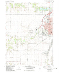
1982 Map of Galesburg West
USGS Topo · Published 1983About this map
Galesburg serves as the focal point of this 1980s landscape, where a dense urban core meets the agricultural expanse of western Illinois. The western edge of the city is defined by a heavy concentration of educational and civic institutions, including Knox College, Carl Sandburg College, and Bethany Academy. The town's historical development is anchored by a complex rail network, with the Sante Fe and Burlington Northern lines converging near the city center. To the north, Lake Storey Park provides a significant recreational anchor with its campground and picnic area. Outside the city limits, the terrain transitions into the townships of Coldbrook and Kelly, where small rural settlements like Utah and Surrey are interspersed with family-named landmarks such as Miles Cem and Horney Cem. This survey illustrates the era's suburban expansion, noting features like the Sandburg Mall and the Galesburg Municipal Airport.
Find a feature on this map
74 named features on this map. Tap any name to fly to it.
Don’t see what you’re looking for? This feature index may not catch every label — zoom into the map to look around manually.
Map Details
Editions of this 1982 Galesburg West Map
This is the sole edition of this map. No revisions or reprints were ever made.
Other maps of this area

1921 · Monmouth
USGS Topo · 1:62,500

1923 · Monmouth
USGS Topo · 1:62,500

1923 · Alexis
USGS Topo · 1:62,500

1925 · Alexis
USGS Topo · 1:62,500

1925 · Galesburg
USGS Topo · 1:62,500

1927 · Galesburg
USGS Topo · 1:62,500

1947 · Woodhull
USGS Topo · 1:62,500

1958 · Burlington
USGS Topo · 1:250,000

1958 · Davenport
USGS Topo · 1:250,000

1961 · Burlington
USGS Topo · 1:250,000