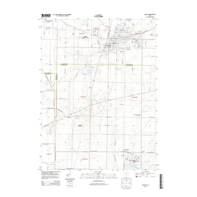
2013 Map of Galion
USGS Topo · Published 2013About this map
Galion serves as the primary municipal center in this north-central Ohio landscape, situated at the headwaters of the Olentangy River. The surrounding rural territory across the Crawford and Morrow County line is defined by a dense network of family and community burial grounds, including the German Evangelical Lutheran Cem and Ebenezer Methodist Episcopal Cem, which anchor the histories of early area congregations. The transition from industrial town to rural expanse is marked by water management features like Powers Reservoir and Amann Reservoir. Further south, the settlement of Iberia sits near the crossing of State Route 309 and the local rail corridor, while the planned community of Candlewood Lake represents more modern residential development around the waters of March Run and Whetstone Creek.
Find a feature on this map
42 named features on this map. Tap any name to fly to it.
Don’t see what you’re looking for? This feature index may not catch every label — zoom into the map to look around manually.
Map Details
Editions of this 2013 Galion Map
This is the sole edition of this map. No revisions or reprints were ever made.
Other maps of this area

1913 · Mount Gilead
USGS Topo · 1:62,500

1915 · Bucyrus
USGS Topo · 1:62,500

1915 · Crestline
USGS Topo · 1:62,500

1915 · Shauck
USGS Topo · 1:62,500

1916 · Mount Gilead
USGS Topo · 1:62,500

1943 · Shauck
USGS Topo · 1:62,500

1943 · Bucyrus
USGS Topo · 1:62,500

1943 · Crestline
USGS Topo · 1:62,500

1943 · Mount Gilead
USGS Topo · 1:62,500

1950 · Marion
USGS Topo · 1:250,000