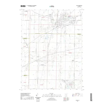
2019 Map of Galion
USGS Topo · Published 2019About this map
The city of Galion anchors the northern reaches of this landscape where the Olentangy River begins its course. To the south and west, the terrain transitions into a patchwork of rural homesteads and historic hamlets, including Iberia, Saint James, and West Point. This document reveals the intricate layout of the regional water system, highlighted by the Amann Reservoir and Powers Reservoir, which serve as prominent landmarks in an area otherwise defined by steady agricultural use and the meandering paths of Rocky Fork and Whetstone Creek.
Find a feature on this map
147 named features on this map. Tap any name to fly to it.
Don’t see what you’re looking for? This feature index may not catch every label — zoom into the map to look around manually.
Map Details
Editions of this 2019 Galion Map
This is the sole edition of this map. No revisions or reprints were ever made.
Other maps of this area

1913 · Mount Gilead
USGS Topo · 1:62,500

1915 · Bucyrus
USGS Topo · 1:62,500

1915 · Crestline
USGS Topo · 1:62,500

1915 · Shauck
USGS Topo · 1:62,500

1916 · Mount Gilead
USGS Topo · 1:62,500

1943 · Shauck
USGS Topo · 1:62,500

1943 · Bucyrus
USGS Topo · 1:62,500

1943 · Crestline
USGS Topo · 1:62,500

1943 · Mount Gilead
USGS Topo · 1:62,500

1950 · Marion
USGS Topo · 1:250,000