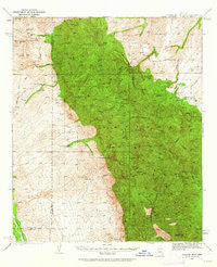
1938 Map of Galiuro Mts
USGS Topo · Published 1962About this map
Galiuro Mountains mining and ranching culture is preserved in this late 1930s survey, showing a landscape defined by isolated homesteads and hard-rock operations. The rugged topography is dotted with family holdings like the Simms Ranch, Rhodes Ranch, and YLE Ranch, while the legacy of the Old West persists at Geronimo Camp and Powers Garden. The eastern slopes of the range are marked by the notable Magna Mine and Powers Mine, connected by a network of drainage systems like Rattlesnake Canyon and Kielberg Canyon. This map captures the region before modern development, where peaks such as Kennedy Peak and Bassett Peak served as the primary navigational anchors for cattlemen and prospectors navigating the Pinal and Graham county lines.
Find a feature on this map
72 named features on this map. Tap any name to fly to it.
Don’t see what you’re looking for? This feature index may not catch every label — zoom into the map to look around manually.
Map Details
Editions of this 1938 Galiuro Mts Map
5 editions found
Other maps of this area

1904 · Tucson
USGS Topo · 1:125,000

1905 · Tucson
USGS Topo · 1:125,000

1911 · Winkelman
USGS Topo · 1:125,000

1913 · Winkelman
USGS Topo · 1:125,000

1938 · Galiuro Mts
USGS Topo · 1:48,000

1938 · Klondyke
USGS Topo · 1:48,000

1940 · Sierra Bonita Ranch
USGS Topo · 1:62,500

1942 · Sierra Bonita Ranch
USGS Topo · 1:62,500

1943 · Galiuro Mts
USGS Topo · 1:62,500

1943 · Klondyke
USGS Topo · 1:62,500