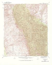
1938 Map of Galiuro Mts
USGS Topo · Published 1968About this map
Geronimo Camp and a network of remote outposts define this high-desert landscape during the late 1930s. The map reveals an economy of isolated cattle ranching and hard-rock mining scattered across the Galiuro Mountains. Operations like the Bunker Hill Mine, Magna Mine, and Sixteen To One Mine are shown tucked into canyons, while livestock interests are represented by the Mercer Ranch, Simms Ranch, and Y L E Ranch.
Find a feature on this map
61 named features on this map. Tap any name to fly to it.
Don’t see what you’re looking for? This feature index may not catch every label — zoom into the map to look around manually.
Map Details
Editions of this 1938 Galiuro Mts Map
5 editions found
Other maps of this area

1904 · Tucson
USGS Topo · 1:125,000

1905 · Tucson
USGS Topo · 1:125,000

1911 · Winkelman
USGS Topo · 1:125,000

1913 · Winkelman
USGS Topo · 1:125,000

1938 · Galiuro Mts
USGS Topo · 1:48,000

1938 · Klondyke
USGS Topo · 1:48,000

1940 · Sierra Bonita Ranch
USGS Topo · 1:62,500

1942 · Sierra Bonita Ranch
USGS Topo · 1:62,500

1943 · Galiuro Mts
USGS Topo · 1:62,500

1943 · Klondyke
USGS Topo · 1:62,500