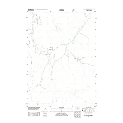
2011 Map of Gallagher Gulch
USGS Topo · Published 2011About this map
White Pine Ridge overlooks a network of high-country drainage basins in Beaverhead County where the Montana and Idaho borders meet. The landscape is defined by the headwaters of the sheep-creek system, including Little Sheep Creek, West Fork Little Sheep Creek, and Straight Creek. These waterways have historically guided both travel and industry through the terrain, as evidenced by the namesake Gallagher Gulch and the nearby Two Springs Gulch.
Find a feature on this map
13 named features on this map. Tap any name to fly to it.
Don’t see what you’re looking for? This feature index may not catch every label — zoom into the map to look around manually.
Map Details
Editions of this 2011 Gallagher Gulch Map
This is the sole edition of this map. No revisions or reprints were ever made.
Other maps of this area

1955 · Dubois
USGS Topo · 1:250,000

1957 · Scott Peak
USGS Topo · 1:62,500

1957 · Edie Ranch
USGS Topo · 1:62,500

1958 · Dubois
USGS Topo · 1:250,000

1965 · Caboose Canyon
USGS Topo · 1:24,000

1965 · Gallagher Gulch
USGS Topo · 1:24,000

1965 · Lima
USGS Topo · 1:24,000

1965 · Dixon Mountain
USGS Topo · 1:24,000

1965 · Dell
USGS Topo · 1:24,000

1965 · Lima Peaks
USGS Topo · 1:24,000