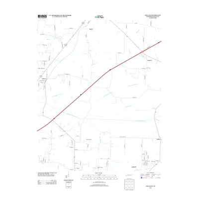
2013 Map of Gallaway
USGS Topo · Published 2013About this map
The town of Gallaway and the surrounding Fayette County landscape are defined by a sophisticated system of twentieth-century water management. Waterways like the Loosahatchie River Canal, Little Cypress Creek Canal, and Laurel Creek Canal illustrate how the natural drainage of west Tennessee was straightened and engineered to support agriculture. These canals cut across the terrain, bypassing the original meandering paths of Beaver Cr and Wilder Cr.
Find a feature on this map
78 named features on this map. Tap any name to fly to it.
Don’t see what you’re looking for? This feature index may not catch every label — zoom into the map to look around manually.
Map Details
Editions of this 2013 Gallaway Map
This is the sole edition of this map. No revisions or reprints were ever made.
Other maps of this area

1943 · Collierville
USGS Topo · 1:62,500

1949 · Moscow
USGS Topo · 1:62,500

1952 · Stanton
USGS Topo · 1:24,000

1952 · Lambert
USGS Topo · 1:24,000

1952 · Stanton
USGS Topo · 1:62,500

1953 · Collierville
USGS Topo · 1:50,000

1954 · Mason
USGS Topo · 1:62,500

1956 · Blytheville
USGS Topo · 1:250,000

1959 · Blytheville
USGS Topo · 1:250,000
1965 · Oakland
USGS Topo · 1:24,000