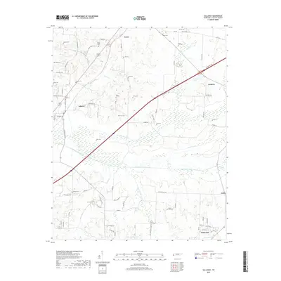
2019 Map of Gallaway
USGS Topo · Published 2019About this map
The Loosahatchie River Canal and Little Cypress Cr Canal dominate the central landscape of this Fayette County region, reflecting an engineered drainage system designed to manage the low-lying wetlands of the Loosahatchie basin. The settlement of Gallaway sits at a crossroads near the western edge, while the town of Oakland anchors the southern boundary. This area is remarkably dense with family and community burial grounds, providing a significant resource for genealogical research. Locations like Poplar Springs Cem, Union Hill Cem, and Scotts Chapel Cem are scattered throughout the rural landscape, often situated near small drainages like Cane Cr or Beaver Cr. In the north, Braden serves as a local hub, while the presence of W W Wilder Lake and Greshams Lake marks the transition into the more varied hydrology of the southern reaches toward Griffen.
Find a feature on this map
85 named features on this map. Tap any name to fly to it.
Don’t see what you’re looking for? This feature index may not catch every label — zoom into the map to look around manually.
Map Details
Editions of this 2019 Gallaway Map
This is the sole edition of this map. No revisions or reprints were ever made.
Other maps of this area

1943 · Collierville
USGS Topo · 1:62,500

1949 · Moscow
USGS Topo · 1:62,500

1952 · Stanton
USGS Topo · 1:24,000

1952 · Lambert
USGS Topo · 1:24,000

1952 · Stanton
USGS Topo · 1:62,500

1953 · Collierville
USGS Topo · 1:50,000

1954 · Mason
USGS Topo · 1:62,500

1956 · Blytheville
USGS Topo · 1:250,000

1959 · Blytheville
USGS Topo · 1:250,000
1965 · Oakland
USGS Topo · 1:24,000