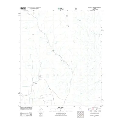
2011 Map of Galleta Flat West
USGS Topo · Published 2011About this map
White Cross Cemetery and the World University campus sit at the heart of this Pima County landscape, where the high desert terrain transitions into the foothills of North Star Peak and San Juan Hill. The area is defined by a network of ranching outposts, including Stansbury Ranch, Martinez Ranch, and Mackenzie Ranch, connected by rugged passages like N Mescal Rd.
Find a feature on this map
34 named features on this map. Tap any name to fly to it.
Don’t see what you’re looking for? This feature index may not catch every label — zoom into the map to look around manually.
Map Details
Editions of this 2011 Galleta Flat West Map
This is the sole edition of this map. No revisions or reprints were ever made.
Other maps of this area

1904 · Patagonia
USGS Topo · 1:125,000

1904 · Tucson
USGS Topo · 1:125,000

1905 · Patagonia
USGS Topo · 1:125,000

1905 · Tucson
USGS Topo · 1:125,000

1915 · Benson
USGS Topo · 1:125,000

1926 · Whetstone
USGS Topo · 1:62,500

1943 · Benson
USGS Topo · 1:125,000

1945 · Happy Valley
USGS Topo · 1:62,500

1956 · Nogales
USGS Topo · 1:250,000

1956 · Tucson
USGS Topo · 1:250,000