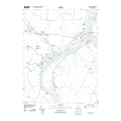
2011 Map of Gallipolis
USGS Topo · Published 2011About this map
The Ohio River carves a wide path through this river valley, anchoring the historic waterfront of Gallipolis and the neighboring West Virginia settlements of Point Pleasant and Henderson. By the early 21st century, the landscape shows a dense network of residential development, from the Evans Heights and Hanersville neighborhoods to subdivisions like Iva Dale Subdivision and Hawk Subdivision. The confluence of the Kanawha River with the Ohio is a focal point of activity, marked by the Silver Memorial Bridge and the Point Pleasant Post Office.
Find a feature on this map
113 named features on this map. Tap any name to fly to it.
Don’t see what you’re looking for? This feature index may not catch every label — zoom into the map to look around manually.
Map Details
Editions of this 2011 Gallipolis Map
This is the sole edition of this map. No revisions or reprints were ever made.
Other maps of this area

1906 · Bidwell
USGS Topo · 1:62,500

1906 · Athalia
USGS Topo · 1:62,500

1906 · Glenwood
USGS Topo · 1:62,500

1908 · Bidwell
USGS Topo · 1:62,500

1908 · Athalia
USGS Topo · 1:62,500

1908 · Glenwood
USGS Topo · 1:62,500

1908 · Point Pleasant
USGS Topo · 1:62,500

1926 · Point Pleasant
USGS Topo · 1:62,500

1929 · Point Pleasant
USGS Topo · 1:62,500

1957 · Beech Hill
USGS Topo · 1:24,000